In our technologically advancing age, we’re continually introduced to innovations that sound straight out of a sci-fi novel. Ground Penetrating Radar (GPR) and Electromagnetic (EM) Locating are such wonders that often mingle in the lexicon of those venturing below the surface. But what separates these two? Dive in as we demystify these remarkable technologies.
Historical Glimpse of GPR
When we hear of radar, our minds often dart to aviation or weather forecasting. Yet, in the 1930s, a unique application emerged: gauging the depth of glaciers. This was the birth of GPR. As decades rolled, by the 1980s, its potential unfolded beyond icy terrains, permeating sectors from construction to archaeology.
Its genius? It’s indiscriminate. Metallic or non-metallic, GPR’s embrace is all-encompassing. From tracing water lines snaking beneath urban sprawls to spotting ancient relics buried for millennia, GPR has reshaped our interaction with the world below.
Ground Penetrating Radar and Electromagnetic Locating: Siblings, not Twins
While both GPR and EM Locating are crucial to Subsurface Investigation Methodology (SIM), they’re distinct in operation and application. Like siblings with unique talents, each shines under different circumstances.
How does Ground Penetrating Radar Work and What Is It Used for?
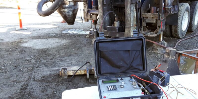
GPR operates like an orchestra, where the transmitter, receiver, and control unit play harmonious notes. The transmitter sends signals into the depths, which then bounce off obstacles, creating echoes. The receiver captures these echoes, painting a vivid subsurface picture.
Its precision, however, dances with external elements. Variables like soil types can either amplify its prowess or diminish its clarity. In scenarios where GPR faces challenges, EM locating emerges as the reliable sibling, filling in the gaps and ensuring no stone remains unturned, figuratively speaking.
From scouting archaeological sites, and mapping ice depths, to urban planning, GPR’s applications are vast. Its depth of reach, though, varies with terrains. While icy terrains divulge secrets hundreds of feet deep, clayey soils might prove reticent.
Commonly Asked Questions on GPR:
- Is it possible for GPR to pinpoint the exact dimensions of a hidden cavity?
While GPR can discern the location and outline of a void, it can’t precisely gauge its depth.
- Can GPR be employed to analyze Concrete Masonry Unit (CMU) walls?
Absolutely. GPR is effective in detecting both the grout and the vertical reinforcing bars present within the CMU framework.
- Does GPR function effectively on upright structures or overheads?
Certainly. Whether it’s locating reinforcement in concrete pillars and walls or scanning the lower surface of a slab to identify reinforcing materials and enclosed conduits, GPR does the job.
- Can GPR help spot graves that lack markers?
Indeed. GPR is adept at pinpointing the positions of graves without markers for planning purposes. However, it’s worth noting that determining the location of more ancient burial sites can be challenging due to the degradation of materials. Despite that, in the majority of instances, the positions of the graves can be precisely identified.
- Are there any constraints to using GPR?
Absolutely. Factors such as the composition of the ground, environmental conditions, and the nature of the material being identified can influence its effectiveness. Nevertheless, a skilled GPR operator can evaluate the specifics of your site to judge whether GPR is the ideal instrument for the task.
- Is the use of GPR harmless?
Without a doubt. GPR stands out as a secure, unobtrusive, and non-destructive technique. It refrains from producing any detrimental radiation, other detrimental byproducts, or noise. Furthermore, the area under scan remains untouched.
Probing Beneath with Electromagnetic Locating Technique
Often referred to as EM locating, electromagnetic pinpointing stands out as a primary technique for non-invasively discovering what’s below the surface. EM techniques can be segregated into two primary modes: active and passive.
Active Locating Technique
For EM locating, there’s a proactive transmission of frequencies through the subterranean utilities, leveraging their conductive attributes. The connection points differ based on the utility in question. For instance, to detect water conduits, connections might be made using risers, hydrants, or valves. For electrical or telecommunication indications, they’re usually linked to a cabling network via the utility’s foundational grounding setup. To spot power conduits, connections might involve meter boxes, transformers, or grounding wires. Meanwhile, telecommunication and cable TV systems are identified by transmitting signals to ground cables located in interface boxes, pedestals, or manholes.
A significant advantage of EM locating is its adaptability. It remains largely unswayed by the nature of the ground, proving effective across mediums such as soil, clay, or even water. This makes it especially valuable for detecting utilities under challenging scenarios like within edifices or overcrowded locales.
Passive Locating Technique
On the other hand, passive EM locating detects fields that course through a utility, originating from an external source like operational electricity or radio frequencies. Utilities like water conduits, gas lines, steam pipes, cable TV, and telecommunication wires can inherently transmit these passive signals. However, due to their less reliable nature, professionals generally gravitate towards active methods for better precision.
While some utility spotters occasionally employ passive methods to locate subterranean electric lines—owing to its swiftness and simplicity over direct connections—professionals trained and certified by SIM understand the nuances of when to opt for passive over active methods for optimal accuracy.
Upholding quality in this domain is paramount. Thus, certain construction entities stipulate that utility spotters possess SIM certification, ensuring a uniform quality standard and methodology across projects.
Which Subsurface Scanning Technique is Best for You?
In the vast expanse of subsurface exploration, needs dictate direction. Whether you’re an architect, a historian, a constructor, or simply curious, your requirements will find resonance in either GPR, EM, or both.
The earth beneath isn’t just dirt and rock; it’s a narrative waiting to be narrated. At Scan Plus Tech, we can help you decide which subsurface scanning technique is the best for your project. From archaeological wonders and hidden utilities to future blueprints, we bring the world below to light. Ready to embark on this journey? Contact us today.